Showing posts with label Ranger III. Show all posts

Tuesday, April 8, 2014

Rock Harbor to Mt. Franklin, and Saying Farewell to Isle Royale NP

 Isle Royale continuted:

Well, it's happened again. Over a month has gone by with no blog post. I was getting ready for my first show of the season, which happened to be all the way down in Houston, Texas, the last weekend in March. I had a lot to get ready, then four days total on the road, one day for set up, three days for the show, with a couple of days for birding on Galveston Island thrown in. I always think I will have more time than I do, and I just never managed to get to my office and finish this series. And so....

I had worked it out with John that I would be on the first boat back to Rock Harbor Tuesday morning. We loaded a bunch of gear into the skiff and Alan piloted the boat back to civilization. John and I picked out a shelter for our group to use. It was going to be a tight fit, with six of us squeezing in.

Once we were settled I got ready for my hike up Mt. Franklin. I was going to have to hoof it if I was to make it back in time for dinner. It is a nine mile hike up and back, so I figured if I left Rock Harbor by 11 am I would have time for lunch at the summit and then be able to get back down by 6 pm, get changed and ready for dinner at 7 pm. I borrowed a small backpack from John to carry rain gear, lunch and a miscellany of other things, and stepped onto the trail.

Before I had even left Rock Harbor, I ran into Sarah. Remember Sarah? She is the retired nurse I met on the Ranger III who was doing a seven day backpacking trip. Solo. With borrowed equipment. Never having backpacked before. I was quite relieved to see her, actually, and she told me all about her adventures and misadventures. She was sporting a black eye, compliments of one of many falls on the trail. But the parks folks had kept an eye on her, and given her permission to stay several nights at Three Mile campground (the first along the trail west from Rock Harbor and usually a one night only campground), then OK'd her to return to Rock Harbor and stay in a shelter for several nights. I suspect they figured that would be easier on them than having to go rescue her in the backcountry. It was decided that I would share her shelter as she was alone in it, freeing up some space in ours. Once I finally began my hike I was 15 minutes behind schedule.

I don't like hiking in a hurry. I like to take my time and see things and catch my breath. But I didn't have that luxury if I wanted to make it back in time for dinner, so I set a quick pace. My plan was to get to the top with enough time to eat and relax for a little while, then I'd know how fast I had to come back down.


Tobin Harbor Trail towards Mt. Franklin/Three Mile campground.

I really had to resist the urge to stop and look at flowers and butterflies, though there were a few things that forced me to stop, like these Red-breasted mergansers resting on a log.


Red-breasted mergansers, a life bird that I saw several times on this trip.

Calypso orchids lined the trail, along with many other wildflowers. June is the time to go if you're into plants!


Calypso orchids along the Tobin Harbor trail.

Butterflies were everywhere, all different kinds. This tiger swallowtail was feeding on blue-bead lilly flowers.


Tiger swallowtail.

Once the Tobin Harbor trail meets the trail for Mt. Franklin it takes a turn to the north, and crosses Tobin Creek, the marshy area at the west end of Tobin Harbor.


Boardwalk across Tobin Creek.

Up and up the trail climbs, passing a beaver pond where later I saw Wood and Ring-necked ducks.


Beaver pond.

After four and a half miles I finally reached the summit and the famous Greenstone Trail. A left turn took me to a look out over Belle Harbor and to Canada in the distance. I sat down, took off my boots and socks, and ate lunch.


View from Mt. Franklin.


Belle Harbor in the foreground, Canada in the distance.

The rocky summit was covered with wild columbine, and the sound of bees and birdsong filled the air.


Columbine along the Greenstone.

As it turns out, I did not actually reach the official summit of Mt. Franklin. Several hundred feet farther down the trail, past some trees, is the marker for the peak, I later learned. I didn't know this at the time, and I was tired enough when I got there to not care all that much. After 30-45 minutes I put my boots back on, shouldered my pack (which would give me a headache later on--no hip belt), and headed back down towards Rock Harbor. I was able to pace myself going down and spent some time photographing the flora along the way, including this Ram's head orchid.


Ram's head orchid along Mt. Franklin trail.


I had seen these poplars on the way up, but they were not so impressive from that angle. Coming back down they seemed to soar over the trail.


I spotted this old pile of wolf scat along the trail too. I even picked a tooth out of it, a canine from some smallish rodent, but I managed to loose it on the way home.


Wolf scat, with boot for scale.


Back on the Tobin Harbor trail I had the sun to my back, and I took a little more time to enjoy the views of the harbor. The trail also served as a butterfly highway, and I could see their shadows on the path in front of me as they approached from behind. They fluttered along in both directions, narrowly missing me as I walked along.


Tobin Harbor.

I made it back to Rock Harbor with plenty of time to get ready for dinner and stretch out sore muscles. I was exhausted--I don't know if I've ever hiked nine miles in a day, and I was not in particularly good shape. But, it's good to know my limits, and that I can take on such a hike as this and still be able to function.

It was a long night sleeping in the shelter, as I had finally gotten used to sleeping alone in my tent. I was warm enough, but Sarah snored, and I tossed and turned a lot. At dawn I got up and got my gear packed and onto one of the carts to be loaded onto the Ranger III, then made my way to the restaurant for a group breakfast. John and Allen had come up for breakfast and to make sure we all got on the boat.


The Ranger III at Rock Harbor.


It was another glorious day, and a fine one for the trip back to Houghton. I know we got very lucky with the weather, especially for those trips across Superior. It can be a very rough ride in bad weather, and many people experience terrible seasickness. I would suggest keeping Dramamine on hand just in case.


Leaving Rock Harbor aboard the Ranger III

I can't say enough what an amazing experience this was. I worked with some wonderful people, had some amazing experiences, and really fell in love with the place. I am looking forward to going back some day.


Tuesday, December 31, 2013

Day One on Isle Royale

Isle Royale continued

Before we get started I want to show you a few more maps that give a better idea of where I was on the island. As I have mentioned, Isle Royale is about 40 miles long and 9 miles wide at its widest point. As I was not there to backcountry camp but to work on restoring some of the structures on the northeast end of the island, I actually saw very little of the park. Most of the cottages are along Tobin Harbor, so that is where I spent my time.


The red box shows approximately where the closeup map below is located.


Purple line shows the water route to the dock for the Dassler Cabin and the location of the cabin. When the weather's good this is the most convenient route, but it is possible to get to Rock Harbor by going down Tobin Harbor. It is about 1/4 mile hike from the docks on Tobin Harbor to Rock Harbor so that route is avoided if there's lots of stuff to haul.


We had arrived at Rock Harbor around 2:40 pm, and within a half hour I was on my way to Scoville Point and the Dassler cabin with a skiff full of food and gear. Alan, our certified boat operator, was at the helm and I traveled with Mary, a veteran of the volunteer crew and our primary cook, although I had volunteered to cook three of our dinners.


The Ranger III at the Rock Harbor docks.

The day remained clear and relatively calm, and we had a pleasant 20 minute boat ride.


Rock Harbor Lodge. People pay A LOT of money to stay here!

We chugged along and I marveled at the scenery, all rocky and thick with black spruce. Before I knew it there was the Dassler cabin, perched upon its own little promontory across a small cove from Scoville Point.

The Dassler Cabins. Sleeping cabin is on the left, the main cabin on the right. I don't know why this image is so overexposed but it's the only one I got from this view.

The Dassler Cabin doesn't have its own dock. The one the Dasslers put in kept getting swept away by ice and storms, so we used one perhaps a quarter mile farther down Tobin Harbor that is also used for access to two other nearby cottages, one which is still occupied. Alan dropped Mary and I at the dock with all our gear and Rubbermaid tubs full of food and supplies and went back for more people. This was perhaps the most exhausting and treacherous part of the trip, carrying the bins over rocky, uneven ground all the way back to the cabin. We made four trips in all, three with bins and one with our gear. My arms hurt for two days!


The Dassler sleeping cabin, with the tip of Scoville Point on the right across the cove. This building has two rooms and is very bright inside, and if I ever won a residency on Isle Royale, this is where I'd spend most of my time. The sleeping cabin is about 25 yards from the main cabin.

The Dassler Cabin, as seen from the front, or water side. It's pretty dark inside, with its small windows, dark panelling and surrounded by trees. The trees cannot be cut as the cabin is in a wilderness area. This covered area served as our dish washing station. 

There is of course no running water, so all water consumed must be filtered. We'd bring water up from the cove and have water filtering parties. There is a filtration system set up inside but it wasn't working properly--one of the tasks on our list for the week was to clean it up and get it going again. I had brought my gravity-style filter, where you fill up the top bag, open a valve, and the water flows down through the filter into the bottom bag--or in our case, a bucket. Needless to say this is much less work and I spent a lot of my free time filtering water.


Alan, Liz and Roger filter water behind the Dassler Cabin.

After dinner I had some time to explore the cove. I'd been told a loon had been hanging out there for several days, and I'd noticed a few other water birds, so I went down and sat on the rocky shore.


Cove near Dassler cabin.


Dassler sleeping cabin. There is a bedroom in the main cabin as well.

The loon was not at all bothered by my presence, and came quite close to me.


Common loon. Their calls rang out across the cold water at all hours of the day and night. I woke several times that first night to their haunting songs.

As I sat, the other birds swam slowly closer and closer. They seemed more ill at ease with the loon's presence than mine. These turned out to be a new bird for me--Red-breasted mergansers. I love the wispy little feathers sticking out from the backs of their heads.


Life-list birds! Red-breasted mergansers.

Back up by the cabin I walked to the Tobin Harbor side to watch the sun set. I don't think there's ever been a better place to put a bench.

Dassler cabin bench, with the point of Smith Island on the left.

It took only six hours for me to fall in love with this place.

Sunset over Tobin Harbor.

We were warned about the voracity of the mosquitoes after dark, so I made my way back to my tent site. The moose kept this area clear of trees. There were five or six of us camping in this general area, but I think that is not going to be allowed in the future. There are occasionally hikers that come down this way and the park staff are left to explain why there are folks camping here. I crawled into bed listening to the songs of the White-throated sparrows, who sang long into the night, then started again early the next morning.


My campsite.

Next: Day two, and a hike to Lookout Louise

Monday, December 16, 2013

Sailing to Isle Royale

 Isle Royale continued

After a lousy night's sleep, Tuesday morning seemed to come very early. I showered, checked my gear one more time and headed down to the docks to await our departure. I did not arrive late but everyone else was early, as there was no where to park when I got there. I had eight or nine Rubbermaid tubs full of food with me--our crew leader, John Dunn, was already on the island, and since I had a full size van I volunteered to haul some of the food. Once I got that and my gear unloaded the Parks folks found me a place to park, squeezed between a bus and a staircase. I had to leave my keys in case they needed to move my van, which was fine with me as that way I couldn't lose them on the island.


Passengers wait to board the Ranger III

The volunteer program is a pretty nifty thing. For $200 for food for seven days and a $100 donation to IRKPA, you get an all-inclusive trip to the island. It cost about $200 in gas there and back, so all in all it was a pretty cheap trip. While the park provides us with a small skiff (16' aluminum boat with a 25 horse motor) to transport people and gear to the work sites, there is always the possibility that the water will be too rough for that to happen, so volunteers are encouraged to only pack what they can carry the two miles from Rock Harbor to the Dassler Cabin, where we were to camp. That's the other thing--only about half of us got to sleep indoors. The rest had to pitch tents in the backcountry, myself included. I was able to pack a few luxuries as I didn't have to pack food, but I still had to be very choosy.

After a safety demonstration and short talk about the boat and trip, we boarded, and left the docks around 8:30 am. It was a cloudy day in Houghton, a gorgeous little town and home to Michigan Tech, but the waters were calm. Thankfully, blessedly calm. The Ranger III is known as the "Barf Barge", and for good reason. Everyone I talked to encouraged me to get Dramamine, although I never had to take it.


Houghton, Michigan from the Ranger III.

We passed under the amazing Portage Lake lift bridge, which links Houghton with Hancock on the far side of the "lake". (The lake is actually kind of a canal that cuts the Keweenaw Peninsula in half--the northern end of the Keweenaw is an island.) Instead of splitting in half and lifting up like a drawbridge, this piece of engineering wonder lifts the roadbed straight up, the ends riding on rails on the towers. How perfectly square this thing has to be to work properly. I was dully impressed.


The Portage Lake lift bridge.

As we made our way west the skies cleared and the sun shone down.


Portage Lake, Keweenaw Peninsula


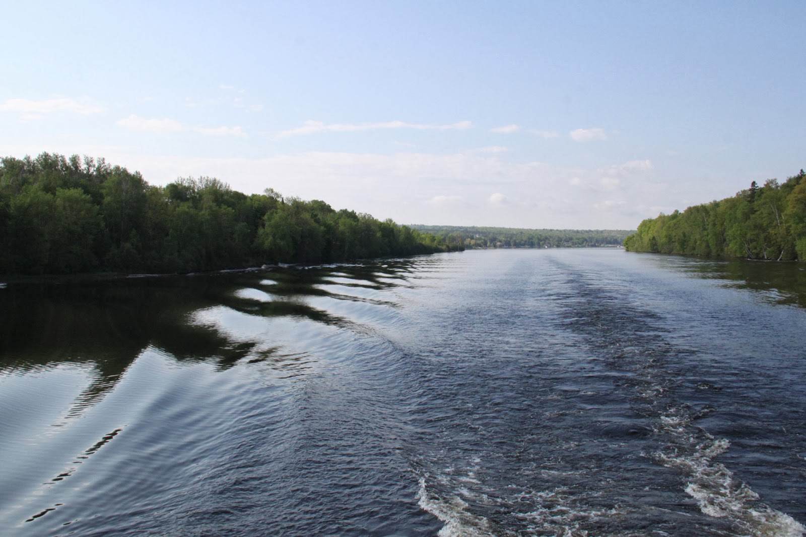
It took about an hour to make our way down the canal and out into the cold waters of Lake Superior. At the end of a breakwater stood the Upper Entrance Light. The skies remained clear and the lake like glass. I could have done a jig right there on the rear deck I was so happy. This was the part of the trip that had me the most worried about, and it looked like we were in for very smooth sailing. We still had good cell service here, so the last calls were made back home, I posted a few pictures on Facebook, then I turned off my phone and put it away. There would be no communication with home for seven days.


Upper Entrance Light, Keweenaw Peninsula

Less than a quarter mile onto Superior a thick fog engulfed us. It was a the strangest sensation, sailing through this thick white blanket while the sun shone down. We couldn't see more that a few tenths of a mile, if that, and the boat's fog horn blared at regular intervals. But the waters remained calm, and after a few hours one of the Park Service employees, a fellow named Paul, and Rolf and Candy Peterson's son (of the famed Isle Royale Wolf Study), whose name now escapes me, put on an impromptu concert on the rear deck.


A joyful noise!

While the guys were still playing I wandered off, and noticed, off our port side, land just visible through the now thinning fog. Isle Royale was in sight!


Land Ho!

Isle Royale lies in the northwest end of Lake Superior, much nearer to Canada and Minnesota than Michigan. The map below shows the layout of the island, which is about 40 miles long and nine miles wide at its widest point. It is actually tilted up more than this, but for the sake of fitting in on a map it's been turned clockwise a bit.


Isle Royale map. Click for a larger image

I cropped the map to give a better idea of the route the Ranger III takes (highlighted in purple).


The Ranger III sails past the lighthouse, then stops at Mott Island to drop off people and supplies at the headquarters, then continues on to Rock Harbor.

As we neared the island the lighthouse came into view. As far as I know it is no longer operational, although it has has been restored. Around the corner to the left is the Edison Fisheries and Rolf and Candy Peterson's headquarters, which we'll visit later.


Isle Royale Lighthouse

The main island is surrounded by 450 smaller islands, some bare rock and some with vegetation. The soil is extremely thin here, and it takes a long time for plants to get established.


We stopped at Mott Island for about a half hour, and decided to disembark and look around. This is Sarah, a woman I met on the boat, who was not part of our team. Sarah is a retired nurse, and was spending several months sightseeing the Upper Midwest and Great Lakes regions. She had never been backcountry camping before, but had decided to embark on a seven day hike, with borrowed gear and Walmart specials. I was concerned about her, and made her promise that I would see her on the boat in a week. Quite a gutsy woman, there.


Sarah at the headquarters sign.

We continued on through Rock Harbor. The day was cool, clear and calm.


Rock Harbor

Finally we reached the Rock Harbor facilities. This is where most people go, and stay, when they visit the island. The Ranger III docks here overnight, then heads back to the Keweenaw Wednesday morning, then repeats the trip Friday/Saturday. Here you'll find a gift shop/convenience store, the island headquarters, the lodges and two restaurants. While the vast majority of the island is designated wilderness, the area around Rock Harbor is not.


Rock Harbor facilities and docks.

We disembarked, gathered up our gear and crew, and began loading up our skiff for the next leg of our journey, the trip to Scoville Point and the Dassler cabin (next).